
Mastering Traffic Collision Analysis with FAROZone’s Advanced Features
- R Rider
- Jun 30, 2024
- 13 min read
Updated: Mar 19
In the rapidly evolving field of traffic collision analysis, technology plays a pivotal role in enhancing accuracy AND efficiency. The integration of advanced tools and systems has revolutionized the way experts investigate and reconstruct accidents, leading to more precise outcomes and improved safety measures.
Among these innovations, tools such as FAROZone, advanced imaging techniques like photogrammetry and LiDAR, and EDR (event data recorder) have emerged as game-changers.
This article explores the impact of these technologies, highlighting how they are shaping the future of collision analysis and public safety.
The Early Development of CAD Technology
The inception of CAD (Computer-Aided Design) technology marked a significant turning point in various industries, including public safety and forensic science. The early days of CAD technology development were a testament to the innovation and perseverance required to transform complex manual processes into streamlined digital solutions.
In the 1980s and 1990s, the adoption of CAD technology was in its infancy, with many industries still relying on traditional methods of drafting and design. Visionaries recognized the potential of digital tools to revolutionize these processes and embarked on missions to make CAD technology accessible and practical for public safety applications. The initial challenges included creating software that was both powerful and user-friendly, catering to professionals accustomed to manual drafting techniques.
The early development phase involved extensive research and collaboration with public safety professionals to understand their unique needs and workflows. Developers focused on creating intuitive interfaces and functionalities that would allow users to transition seamlessly from paper-based methods to digital designs. This involved iterative testing and refinement to ensure that the software could handle the intricate details required in public safety scenarios, such as fire pre-planning and forensic diagramming.
One of the key breakthroughs was the development of FireZone, a specialized CAD tool designed for fire departments. By working closely with fire bureaus, the development teams were able to tailor the software to address specific challenges faced by firefighters, such as pre-fire planning and scene management. This collaborative approach resulted in a highly effective tool and set a precedent for future developments in CAD technology for public safety.
The early development of CAD technology laid the foundation for the sophisticated tools we have today. These efforts transformed the way public safety professionals approached their work, enabling more precise and efficient planning, analysis, and documentation.
Integrating CAD into Public Safety Training
Integrating CAD (Computer-Aided Design) technology into public safety training has revolutionized how first responders prepare for emergencies, enhancing their ability to visualize and respond to complex scenarios. In the early stages, this integration faced numerous challenges, but the potential benefits quickly became evident, driving widespread adoption and continual refinement of these digital tools.
The primary goal of incorporating CAD into public safety training was to create realistic, interactive simulations that could better prepare personnel for real-life situations. Traditional training methods often relied on static diagrams and manual exercises, which, while useful, lacked the dynamic and immersive qualities necessary for comprehensive preparedness. CAD technology provided the solution by offering detailed, scalable, and manipulable digital models of various environments.
One of the most significant advancements was the use of CAD in fire pre-planning and incident management. Fire departments began using specialized CAD software, like FireZone, to create accurate digital representations of buildings and other structures. These detailed diagrams allowed firefighters to familiarize themselves with the layouts of key buildings in their jurisdictions, identifying critical features such as fire exits, hazardous materials, and potential obstructions. By conducting virtual walkthroughs and drills using these CAD models, firefighters could develop strategic plans for various scenarios, improving their readiness and response times during actual emergencies.
Moreover, CAD technology facilitated the development of comprehensive training programs that could simulate diverse and complex incidents. Trainees could engage with interactive models, navigating through different scenarios and making real-time decisions based on changing conditions. This level of interactivity not only enhanced learning outcomes but also helped to build confidence and improve decision-making skills under pressure.
Beyond fire departments, CAD technology found applications in other areas of public safety training, including law enforcement and emergency medical services. Police officers used CAD tools to recreate crime scenes for investigative training, allowing them to practice evidence collection and analysis in a controlled, virtual environment. Similarly, paramedics used CAD simulations to plan and execute emergency medical responses, practicing their skills in scenarios ranging from mass casualty incidents to everyday emergencies.
The integration of CAD into public safety training continues to evolve, with advancements in technology providing even more sophisticated tools and capabilities. Virtual reality (VR) and augmented reality (AR) are now being combined with CAD models to create fully immersive training environments, further enhancing the realism and effectiveness of these programs. As technology progresses, the potential for CAD to transform public safety training will only expand, leading to better-prepared first responders and safer communities.
Enhancing Traffic Collision Analysis with 3D Modeling
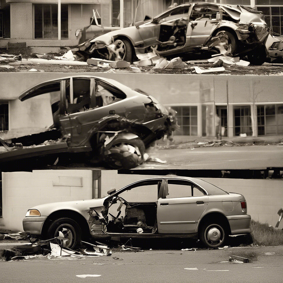
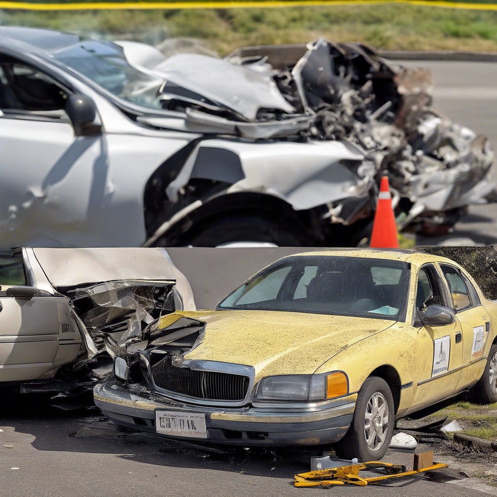
Traffic collision analysis has long been a critical component of public safety, aiming to understand the causes and consequences of accidents to improve road safety and prevent future incidents. Traditional methods relied heavily on physical measurements, photographs, and witness statements, which, while valuable, often lacked the precision and comprehensive perspective needed for thorough investigations. The advent of 3D modeling technology has significantly enhanced traffic collision analysis, offering unprecedented accuracy and detail in reconstructing accident scenes.
3D modeling involves creating detailed, three-dimensional representations of accident sites using data collected from various sources, such as laser scanners, drones, and photogrammetry. These models provide a comprehensive and accurate depiction of the scene, capturing minute details that might be overlooked or misinterpreted through conventional methods. Investigators can now visualize the entire environment, including road conditions, vehicle positions, and surrounding structures, with a high degree of accuracy.
One of the primary benefits of 3D modeling in traffic collision analysis is its ability to facilitate precise measurements and calculations. Traditional scene reconstruction methods often required manual measurements, which could be time-consuming and prone to errors. In contrast, 3D models allow investigators to measure distances, angles, and other critical parameters directly within the digital environment. This precision enables a more accurate assessment of factors such as vehicle speeds, collision dynamics, and the sequence of events leading up to the accident.
Moreover, 3D modeling technology enhances the visualization and presentation of accident scenes. Investigators can create realistic animations and simulations that depict how the collision occurred, providing a clear and comprehensible representation of the event. These visualizations are particularly valuable in legal contexts, where they can be used as evidence in court proceedings. Judges, juries, and other stakeholders can better understand the complexities of the accident through interactive and visually compelling presentations.
Another significant advantage of 3D modeling is its ability to integrate and analyze data from multiple sources. Modern traffic collision investigations often involve various data inputs, including vehicle EDR, surveillance footage, and environmental sensors. 3D modeling platforms can consolidate these diverse data streams into a unified model, offering a holistic view of the accident. This integration allows for more comprehensive analyses, identifying contributing factors that might not be apparent through isolated data points.
As technology continues to advance, the capabilities of 3D modeling in traffic collision analysis will only expand. Future developments may include enhanced integration with real-time data sources, more sophisticated simulation tools, and greater accessibility for public safety agencies of all sizes. By leveraging these innovations, traffic collision analysis can become even more precise and impactful, ultimately contributing to safer roads and better-informed public safety strategies.
Utilizing Photogrammetry for Accurate Collision Reconstruction
Photogrammetry has emerged as a transformative tool in the field of collision reconstruction, providing a method to create detailed and accurate 3D models of accident scenes using photographs. This technique leverages the principles of triangulation and perspective to derive spatial information from 2D images, offering a precise and comprehensive representation of the scene.
The process begins with capturing a series of overlapping photographs from different angles around the accident site. These images are then processed using specialized software that identifies common points in the photographs and calculates their spatial relationships. The result is a highly detailed 3D model that accurately depicts the scene's geometry, including the positions of vehicles, road features, and any other relevant objects.
One of the key advantages of photogrammetry is its ability to preserve the scene's integrity long after the initial investigation. Accident scenes can change rapidly due to environmental conditions, cleanup efforts, and traffic flow. Photogrammetry allows investigators to capture and document the scene comprehensively at the time of the incident, ensuring that no critical details are lost. This preserved digital record can be revisited and analyzed at any point during the investigation, providing a reliable reference for reconstructing events.
The precision of photogrammetry also enhances the accuracy of collision analysis. Traditional methods, such as manual measurements and sketches, can introduce errors and inconsistencies, especially in complex scenes. Photogrammetry, on the other hand, provides exact measurements of distances, angles, and elevations, ensuring that the analysis is based on precise and consistent data. This accuracy is crucial for determining factors such as vehicle speeds, trajectories, and points of impact, which are essential for understanding the collision dynamics.
Moreover, photogrammetry offers significant advantages in visualizing and presenting the reconstructed scenes. The 3D models generated through photogrammetry can be manipulated and viewed from any angle, allowing investigators to explore different perspectives and scenarios. These models can also be animated to simulate the sequence of events leading to the collision, providing a clear and intuitive understanding of how the accident occurred. This visual clarity is particularly beneficial in legal contexts, where it can aid in conveying complex technical information to judges, juries, and other stakeholders.
Another important benefit of photogrammetry is its ability to integrate with other data sources and technologies. For instance, the 3D models created through photogrammetry can be combined with data from vehicle EDR, surveillance cameras, and witness statements to provide a more comprehensive analysis. This integration allows investigators to cross-reference different data points and corroborate findings, leading to a more thorough and robust investigation.
The use of photogrammetry also improves the efficiency and effectiveness of collision investigations. Traditional scene documentation methods can be time-consuming and labor-intensive, often requiring multiple personnel and extensive equipment. Photogrammetry streamlines this process, enabling a single investigator to capture the necessary photographs quickly and with minimal disruption to the scene. The subsequent processing and analysis can be conducted using software tools, reducing the time and resources needed for a complete investigation.
As photogrammetry technology continues to advance, its applications in collision reconstruction are likely to expand. Future developments may include enhanced automation, real-time processing capabilities, and integration with emerging technologies such as augmented reality. By embracing these innovations, investigators can further improve the accuracy, efficiency, and impact of collision reconstruction, ultimately contributing to safer roads and more effective public safety practices.
The Integration of Drones in Accident Scene Documentation
The integration of drones in accident scene documentation has revolutionized the way investigators approach collision reconstruction. Drones, also known as unmanned aerial vehicles (UAVs), provide a bird's-eye view of accident scenes, capturing high-resolution images and videos that are invaluable for analysis and reconstruction. This technology offers several advantages, including enhanced accessibility, efficiency, and data accuracy.
One of the primary benefits of using drones is their ability to access and document accident scenes quickly and efficiently. In situations where traditional ground-based methods might be hindered by obstacles, rough terrain, or hazardous conditions, drones can easily fly over and capture comprehensive views of the scene. This capability is particularly valuable in large or complex accident sites, such as multi-vehicle collisions, where capturing the entire scene from the ground would be challenging and time-consuming.
Drones equipped with high-resolution cameras and advanced sensors can capture detailed images and videos from various angles and altitudes. This aerial perspective provides a holistic view of the accident scene, allowing investigators to see the spatial relationships between vehicles, road features, and other relevant elements. The collected data can be processed to create accurate 3D models and orthomosaic maps, which are essential for precise analysis and reconstruction.
The efficiency of drones significantly reduces the time required for scene documentation. Traditional methods often involve extensive manual measurements, sketches, and photographs taken from multiple vantage points. In contrast, a drone can survey an entire accident scene in a fraction of the time, capturing all necessary data in a single flight. This rapid documentation not only accelerates the investigation process but also minimizes the disruption to traffic and other public services.
Drones also enhance the accuracy of data collection. Human error in manual measurements and documentation can lead to inconsistencies and inaccuracies, affecting the overall analysis. Drones, however, rely on GPS and advanced imaging technologies to capture precise and consistent data. The high-resolution imagery and accurate geolocation information ensure that every detail of the accident scene is documented with precision, which is crucial for reconstructing events and determining causative factors.
The use of drones in accident scene documentation also improves safety for investigators. Traditional methods often require personnel to work in potentially hazardous environments, such as busy highways, unstable terrains, or areas with dangerous materials. Drones can be operated remotely, allowing investigators to document the scene from a safe distance without exposing themselves to these risks. This safety aspect is particularly important in post-accident scenarios where there might be ongoing hazards, such as fires, chemical spills, or unstable structures.
Moreover, the visual data captured by drones can be invaluable for presenting findings in legal and insurance contexts. The aerial imagery and 3D models provide clear and compelling visual evidence that can help explain complex accident scenarios to judges, juries, and insurance adjusters. This visual clarity can be a decisive factor in legal disputes and insurance claims, providing an objective and easily understandable representation of the accident scene.
The integration of drones into accident scene documentation also opens up possibilities for real-time analysis and decision-making. Advanced drones equipped with live-streaming capabilities can transmit real-time footage to command centers, allowing investigators and first responders to assess the situation and coordinate their efforts more effectively. This real-time data can be crucial in emergencies, enabling rapid decision-making and response to evolving situations.
Looking forward, the use of drones in accident scene documentation is expected to expand as technology continues to advance. Future developments may include enhanced autonomous capabilities, improved sensor technologies, and integration with other data sources, such as a vehicle’s event data recorder (EDR) and smart infrastructure. These advancements will further improve the accuracy, efficiency, and safety of accident scene documentation, contributing to better collision reconstruction and public safety outcomes.
In summary, the integration of drones in accident scene documentation represents a significant leap forward in collision reconstruction. By providing quick, accurate, and comprehensive data collection, drones enhance the efficiency and effectiveness of investigations, improve safety for personnel, and offer powerful visual evidence for legal and insurance purposes. As drone technology continues to evolve, its role in accident scene documentation and reconstruction will undoubtedly become even more pivotal.
The Impact of EDR on Collision Analysis
EDR technology has significantly impacted the field of collision analysis, offering detailed insights into vehicle behavior before, during, and after an accident. EDR systems, which combine telecommunications and informatics, collect and transmit data from a vehicle to a central system, providing real-time information on various parameters such as speed, location, braking patterns, and more. This data is invaluable for reconstructing accidents and understanding the dynamics of collisions.
One of the primary benefits of EDR in collision analysis is its ability to provide precise data on vehicle movements and behaviors leading up to an accident. Traditional methods of accident reconstruction often rely on physical evidence, eyewitness accounts, and post-accident analyses, which can be prone to inaccuracies and subjective interpretations. In contrast, EDR systems offer objective and detailed records of vehicle activities, capturing events in real time with high accuracy.
For instance, EDR can record data such as the speed of a vehicle at the moment of impact, the duration and intensity of braking before the collision, and the vehicle's trajectory and movements leading up to the crash. This information allows investigators to reconstruct the sequence of events with a high degree of precision, identifying contributing factors such as excessive speed, sudden braking, or erratic driving patterns. This level of detail is crucial for determining the causes of the crash and assigning liability.
EDR data also enhances the ability to analyze driver behavior over time, providing insights into patterns that may have contributed to the crash. By examining historical data, investigators can identify whether a driver has a history of aggressive driving, frequent speeding, or other risky behaviors. This information is valuable not only for understanding the specific incident but also for broader safety and risk management purposes. For example, fleet managers can use EDR data to identify and address risky driving behaviors among their drivers, potentially preventing future crashes.
In addition to vehicle and driver behavior, EDR systems can also provide critical information on environmental conditions at the time of the accident. Many EDR devices are equipped with sensors that monitor external factors such as weather conditions, road surface quality, and traffic density. This data helps create a comprehensive picture of the accident scene, allowing investigators to consider external factors that may have influenced the collision.
The integration of EDR data into collision analysis also improves the accuracy and reliability of legal and insurance proceedings. In legal disputes and insurance claims, EDR data serves as objective evidence that can substantiate or refute claims made by the parties involved. For example, EDR records can verify whether a driver was speeding or whether they braked suddenly before the collision. This objective data helps reduce the reliance on subjective accounts and enhances the fairness and transparency of the adjudication process.
Moreover, EDR data can be instrumental in the development of advanced safety features and autonomous driving technologies. By analyzing collision data collected from EDR systems, automotive engineers and researchers can identify common causes of accidents and develop targeted interventions to mitigate these risks. For instance, if EDR data reveals a high incidence of rear-end collisions due to sudden braking, manufacturers can improve collision avoidance systems to better detect and respond to such scenarios.
The impact of EDR on collision analysis extends beyond individual accidents to broader traffic safety and policy initiatives. Aggregated EDR data from multiple vehicles and accidents can provide valuable insights into traffic patterns, high-risk areas, and common collision scenarios. This information is useful for traffic planners and policymakers to design safer roads, implement targeted traffic enforcement measures, and develop public safety campaigns.
In summary, EDR technology has transformed collision analysis by providing detailed, real-time data on vehicle and driver behaviors, environmental conditions, and accident dynamics. This technology enhances the accuracy and reliability of accident reconstruction, supports legal and insurance processes, and contributes to the development of advanced safety features and traffic safety initiatives. As EDR systems continue to evolve and become more widespread, their impact on collision analysis and overall traffic safety is expected to grow even further.
Pulling It All Together
The advancements in technology have undeniably transformed the field of traffic collision analysis, offering unparalleled precision and efficiency. Tools like FAROZone, advanced imaging techniques such as photogrammetry and LiDAR, and EDR have each contributed to a deeper understanding of accident dynamics, allowing for more accurate reconstructions and data-driven decision-making. These innovations not only aid in the immediate investigation of accidents but also have broader implications for improving overall traffic safety, policy-making, and the development of advanced vehicle safety features.
As we continue to embrace and integrate these technologies, the future of collision analysis looks promising. Enhanced accuracy, real-time data, and comprehensive environmental insights are setting new standards in the field, ultimately leading to safer roads and better-informed safety measures. The ongoing evolution of these technologies promises even greater advancements, ensuring that collision analysis remains at the forefront of traffic safety and crash prevention.
Comments